Enjoy fast and reliable shipping to any location across Australia.

SKU: PR621349

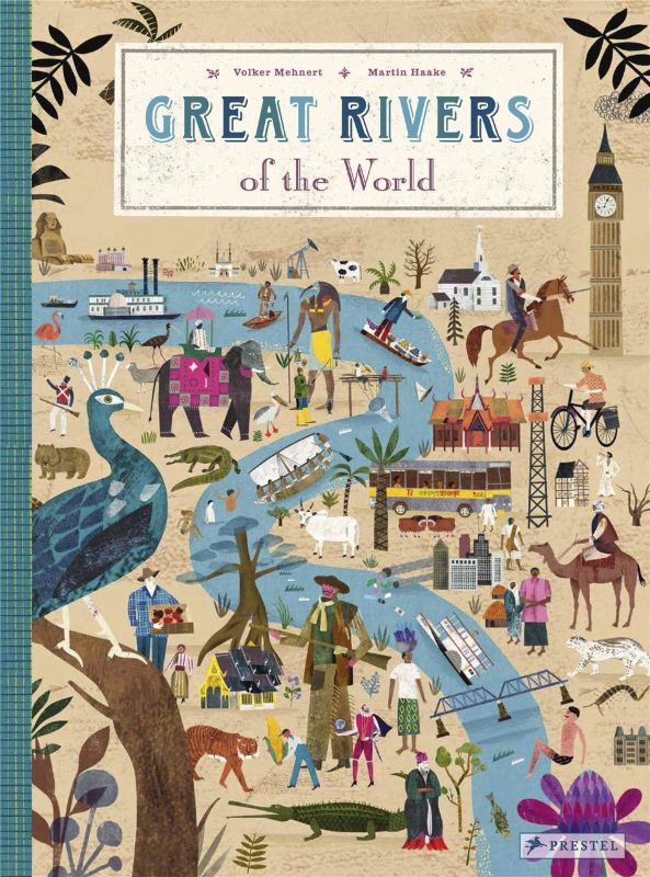
Great Rivers of the World

$45.95 AUD
Discover the enchanting world of rivers with this beautifully illustrated atlas, perfect for children and curious minds alike. This hardback volume, measuring 277 x 370 mm, is an essential educational tool, featuring rich visuals and insightful narratives about the world’s great rivers. From the legendary Rhine, rich with tales of the Nibelung Treasure, to the mighty Mississippi that divides and unites the United States, each river is brought to life with vibrant maps and intricate illustrations. The book covers significant waterways including the Mekong, renowned as the 'Nine Dragon' river of Vietnam, and the sacred Ganges, whose banks inspire pilgrimages in India.

Within these 40 pages, readers will explore significant urban areas that line these rivers, discover various flora and fauna, and learn about the natural and human-made features that shape these essential waterways. Additional fascinating historical facts enrich the reading experience, providing a 'biography' for each river, detailing its journey and significance to local communities.

This atlas goes beyond mere geography—it stresses the ecological health of these rivers, highlighting those nurturing thriving ecosystems and those at risk.

Designed to spark curiosity and encourage a love for learning, this educational book is perfect for young readers eager to understand the vital role rivers play in our world. Dive into the depths of knowledge and let the adventure flow!

Author: Volker Mehnert Publisher: Prestel Publishing
Bind: hardback
Dimensions: 277 x 370 mm
Pages: 40
Publication Date: 04-03-2021

Where along the Rhine does the Nibelung Treasure lie? What river helps mark the prime meridian? Why do people make pilgrimages to the Indian city of Benares? Why is the Mekong called the "Nine Dragon" river in Vietnam? How does the Mississippi divide and unite the United States? These and hundreds of other facts are explored in this wonderfully illustrated atlas of the world's great rivers. Each spread in this book offers a colorful map packed with drawings, figures, and facts. Cities that border the rivers are highlighted, as are distinct flora and fauna, significant natural and human- made features, and fascinating historical details. A "biography" of each river describes where it flows, and its importance to the communities it passes through. Special attention is given to the ecological health of the rivers-those that are thriving and those in danger of losing their valuable habitats. Along the way, young readers will come to understand the enormous impact that rivers have on our lives, while learning valuable information in a way that will spark their curiosity and imagination.

Delivery Information

Delivery takes 3-12 business days after dispatch from our fulfillment center, unless stated otherwise. In most cases, your order will arrive before the 12-day mark; however, some items may take up to the full 12 working days.

Payment & Security

Payment methods

  • American Express
  • Apple Pay
  • Google Pay
  • Mastercard
  • Shop Pay
  • Union Pay
  • Visa

Your payment information is processed securely. We do not store credit card details nor have access to your credit card information.

NATIONWIDE BOOKS

Great Rivers of the World

$45.95 AUD
Discover the enchanting world of rivers with this beautifully illustrated atlas, perfect for children and curious minds alike. This hardback volume, measuring 277 x 370 mm, is an essential educational tool, featuring rich visuals and insightful narratives about the world’s great rivers. From the legendary Rhine, rich with tales of the Nibelung Treasure, to the mighty Mississippi that divides and unites the United States, each river is brought to life with vibrant maps and intricate illustrations. The book covers significant waterways including the Mekong, renowned as the 'Nine Dragon' river of Vietnam, and the sacred Ganges, whose banks inspire pilgrimages in India.

Within these 40 pages, readers will explore significant urban areas that line these rivers, discover various flora and fauna, and learn about the natural and human-made features that shape these essential waterways. Additional fascinating historical facts enrich the reading experience, providing a 'biography' for each river, detailing its journey and significance to local communities.

This atlas goes beyond mere geography—it stresses the ecological health of these rivers, highlighting those nurturing thriving ecosystems and those at risk.

Designed to spark curiosity and encourage a love for learning, this educational book is perfect for young readers eager to understand the vital role rivers play in our world. Dive into the depths of knowledge and let the adventure flow!

Author: Volker Mehnert Publisher: Prestel Publishing
Bind: hardback
Dimensions: 277 x 370 mm
Pages: 40
Publication Date: 04-03-2021

Where along the Rhine does the Nibelung Treasure lie? What river helps mark the prime meridian? Why do people make pilgrimages to the Indian city of Benares? Why is the Mekong called the "Nine Dragon" river in Vietnam? How does the Mississippi divide and unite the United States? These and hundreds of other facts are explored in this wonderfully illustrated atlas of the world's great rivers. Each spread in this book offers a colorful map packed with drawings, figures, and facts. Cities that border the rivers are highlighted, as are distinct flora and fauna, significant natural and human- made features, and fascinating historical details. A "biography" of each river describes where it flows, and its importance to the communities it passes through. Special attention is given to the ecological health of the rivers-those that are thriving and those in danger of losing their valuable habitats. Along the way, young readers will come to understand the enormous impact that rivers have on our lives, while learning valuable information in a way that will spark their curiosity and imagination.

Default

  • Default
View product